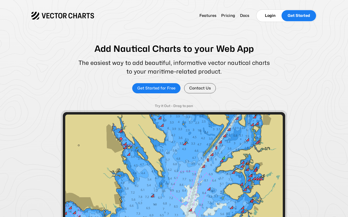
Vector Charts is a new API that enables the integration of modern nautical charts into web applications, offering a higher quality and cost-effective solution for developers in the marine space, with an emphasis on user-friendly and visually appealing mapping experiences.
Vector Tile API, Web-based Map Integration
2025-05-12
- website

Highlight 1
The Vector Tile API offers a modern and high-quality solution for integrating nautical charts into web apps. Its vector-based rendering ensures sharp, clear maps that do not suffer from pixelation, providing a much better user experience compared to raster maps.
Highlight 2
The product is highly accessible for non-safety-critical applications, making it ideal for industries like recreational boating, sailing races, or water sports apps, where precision is important, but the high cost of traditional systems is not justifiable.
Highlight 3
The API is designed to be developer-friendly, providing a simple way for developers to embed maritime charts into their web applications with little effort. This ease of integration significantly reduces the barrier to entry for new maritime-related web apps.

Improvement 1
As the product is still in testing with customers, there are occasional data inconsistencies and missing layers. Improving the data accuracy and completeness would enhance the user experience, especially for developers integrating the API into their apps.
Improvement 2
Although the product aims to modernize the map experience, its styling and customization options could be expanded. More flexibility in customizing map appearance, such as color schemes or chart layers, would give developers more control over the visual presentation.
Improvement 3
The product could improve its documentation and onboarding process. Clearer guides, tutorials, and example code would help new users understand how to use the API effectively, reducing the learning curve and speeding up adoption.
Product Functionality
To improve product functionality, expanding the coverage and completeness of nautical chart data should be a priority. Adding more layers, data sources, or regions would make it a more comprehensive solution for developers.
UI & UX
The user interface for interacting with the product could benefit from a more polished and modern design. Providing interactive demo examples, with better visual cues and tooltips, could improve the user experience, especially for new developers unfamiliar with maritime charts.
SEO or Marketing
To boost visibility, focusing on SEO strategies specific to maritime and developer communities could help attract users. Content marketing in the form of blog posts, tutorials, and case studies could also attract more developers looking for solutions in the maritime domain.
MultiLanguage Support
Adding multi-language support, especially in key maritime regions such as Europe and Asia, would significantly expand the product’s reach. Translating documentation, API interfaces, and user-facing content into multiple languages could attract a global audience.
- 1
What is Vector Charts?
Vector Charts is an API that provides vector-based maritime charts, which developers can integrate into their web applications. It’s designed for non-safety-critical use cases like recreational boating, racing, and watersports apps.
- 2
What are nautical charts and why are they important?
Nautical charts are specialized maps for maritime navigation, showing underwater features, bathymetry contours, and other important information that helps mariners avoid hazards and navigate safely.
- 3
How can I use Vector Charts in my app?
You can sign up on the Vector Charts website and access the API to embed nautical charts into your web-based application. The API is designed to be simple to integrate, with support for customizing map appearance and behavior.